We were hard at work in 2019 improving Trailforks with new features and refinements along with fixing many bugs. While we spend a lot of development time fixing bugs, tweaking backend systems to be more efficient, optimizing database and other boring stuff, we have also continued to add a lot of new features. Some for everyday riders , and others for backend trail association use.
Here is a list of some of the changes we've made in 2019. But first, three big milestones we've hit.
Milestones
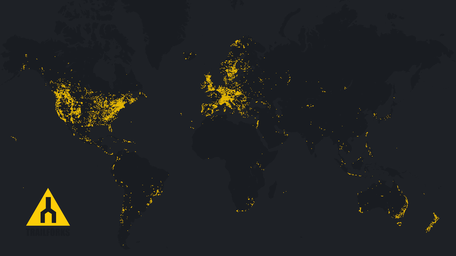
1. Trailforks in September passed 200,000 trails mapped, with 60,000 added in 2019 alone!
How many MTB trails are there in the world? We hope to find out! Instead of starting to plateau or slow down, the number of trails added monthly is increasing!
"Trails being added over 2019"
2. The second big milestone is Trailforks passed its 5 year Pinkbike launch anniversary.
3. The third milestone is we passed 1.5 million app downloads in September!
Website
• Maps switched from Google to Mapbox with a ton of new functionality. This article details the many new map functions.
Activity Types
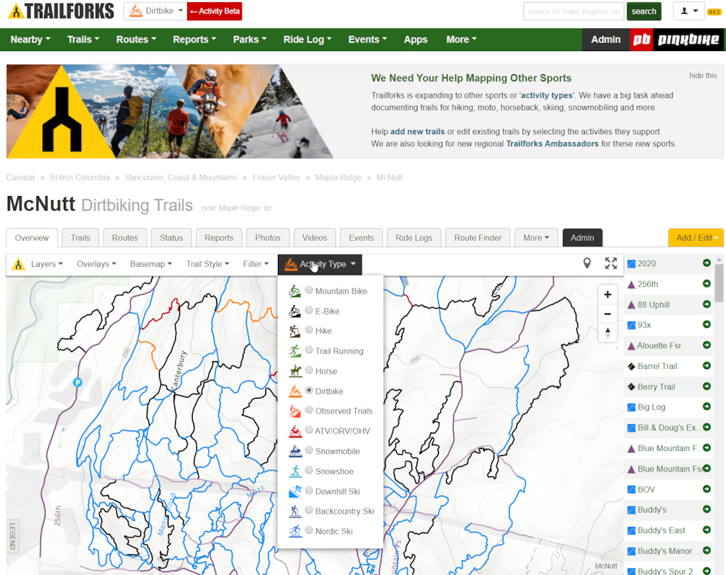
• It's not a big secret that Trailforks is expanding to accommodate a wide range of trail activity types outside our primary mountain bike focus. This has long been requested by users from other activities and from trail associations that manage trails for multiple user groups.
We have decided to go the path of one app to rule them all, rather than creating separate apps for each separate activity. As many users switch often between activities and there is value from a navigation and mapping perspective in seeing other activities trails. Also the name "Trailforks" is a neutral name, nothing that limits it to just mountain biking.
For the foreseeable future mountain biking will still be the main focus and some of the features will only work with mountain biking in mind. But this past winter we've tried to change much of our database, codebase and UI to accommodate trails and users from other activity types. And have been tweaking and improving the multi-activity support all of 2019 as local admins and new user groups start to add their trail data.
We have a big task ahead, mapping the trails for other sports! We want to have a decent amount of hiking, moto, and ski trails mapped before we release the new functionality fully to the public. So we need the help of locals and our awesome Trailforks contributors to map their local non-biking trails and to edit the existing trails adding info about what other activities a trail supports.
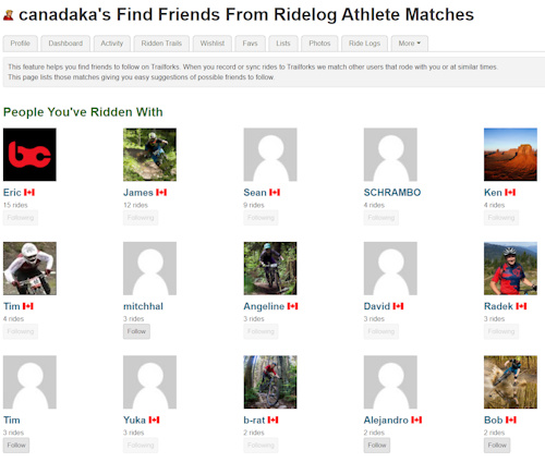
• Starting October 17, we are detecting other people you rode with for ridelogs. We also detect other athletes that rode similar rides during the same time you did. Both these help with a new suggested friends to follow feature.
Click to reveal others that rode during the same time. There is a profile setting to opt-out of ridelog matching.
You can still manually tag friends you rode with, but now this is made easier with the matching.
On your profile settings page there is a link to the new find friends tool.
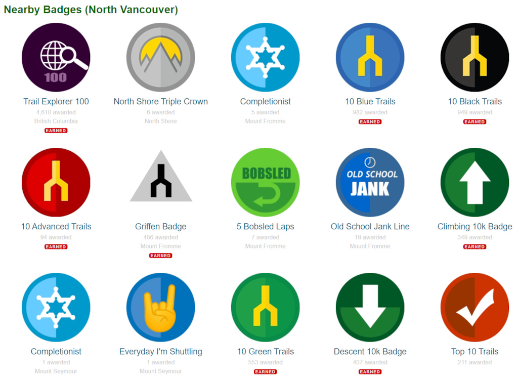
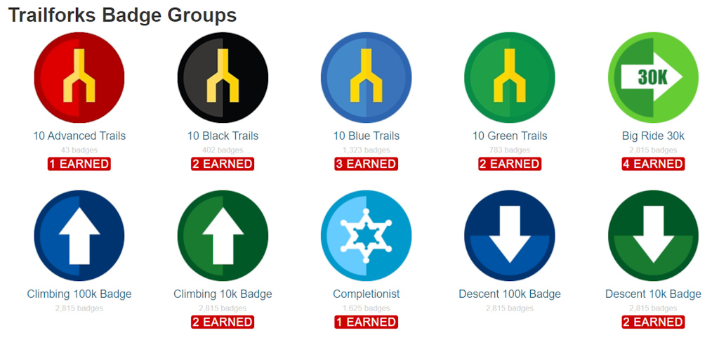
• The ridelog badge system was expanded this year, in the spring we generated thousands of generic badges for regions around the world. So you can earn various badges in each region. Local admins can also create their own custom badges. One of the most fun generic badges is the "Completionist" series, where you have to ride every trail in an area to complete.
• A special badge for donating Trail Karma was created.
• More pages that linked to Pinkbike are being transferred to Trailforks itself, this includes your profile settings pages.
• The Trailforks login and register pages are also now on Trailforks itself rather than Pinkbike.
• New video page on Trailforks, rather than linked to Pinkbike video pages.
• Better Pinkbike article linking to regions and trails using the new Pinkbike news tags system.
• Detailed admin audit log, can be viewed by specific region or trail.
• Save default map home location on Nearby page.
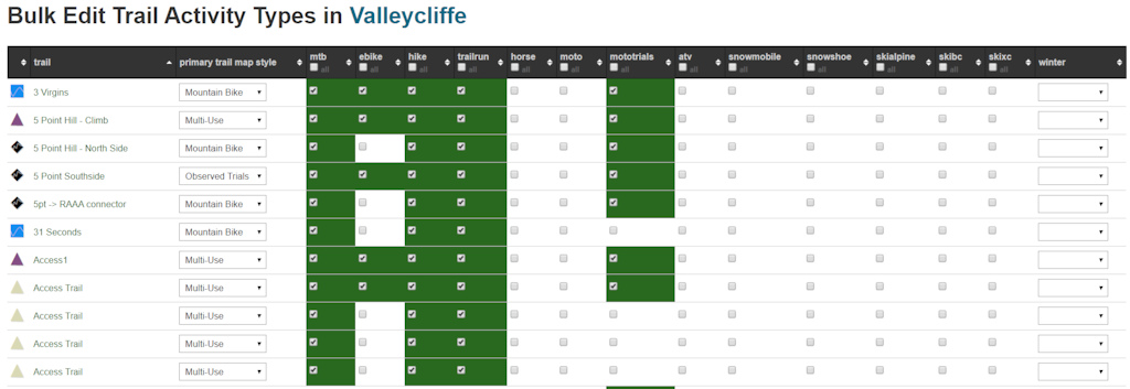
• Admin tool to bulk edit a regions trails activity type data.
• Admin tool to bulk edit trails closure settings.
• New POI types added.
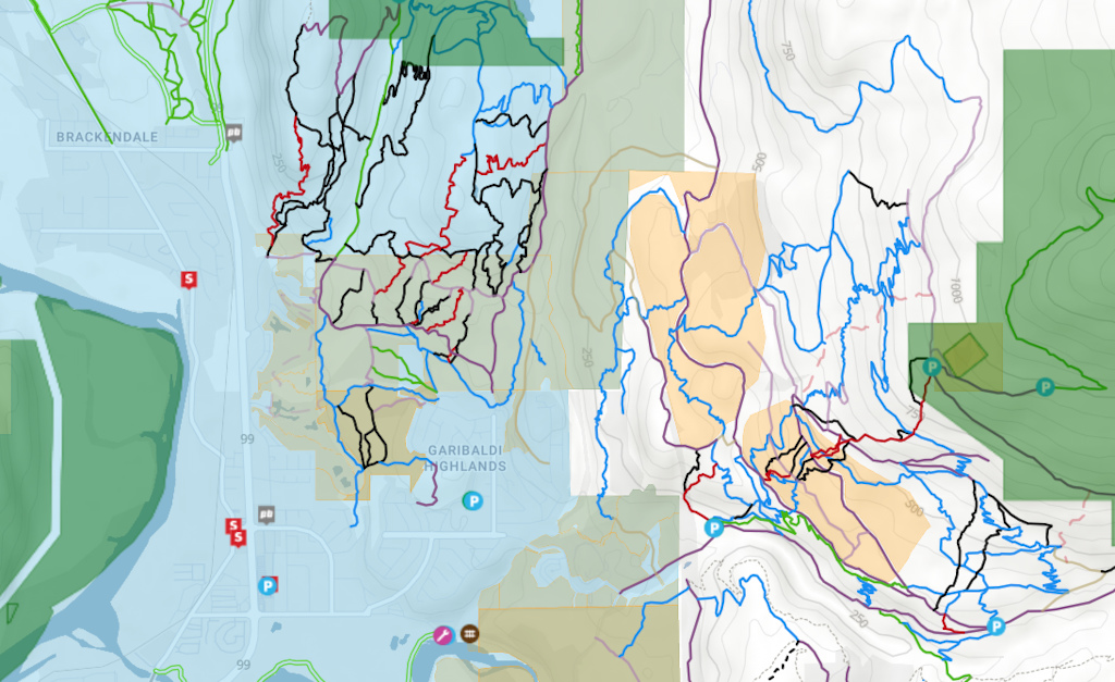
• Custom land owner polygon data moved from deprecated Google Fusion tables to our own Postgres database. Region admins can send us local land owner polygon data that we can include in this map layer.
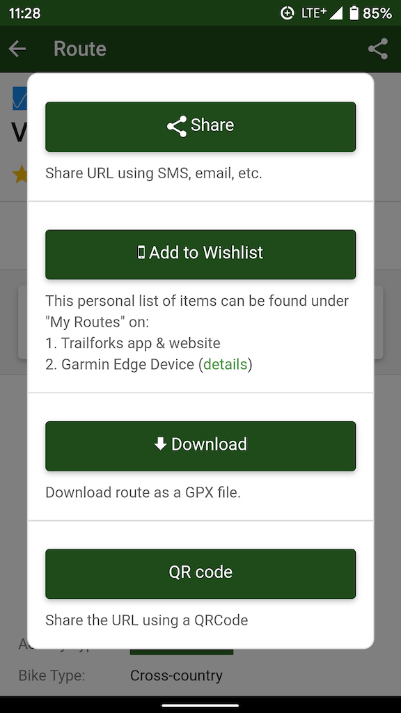
• Share popup for routes & trails with new QR Code option.
• Summary of recent ride data for a trail, can let you know if people are still riding a trail and if it's worth checking out.
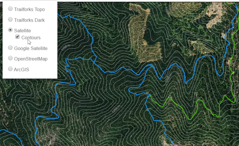
• Contours option for satellite basemap.
• Tool helping users rate trails they've ridden. This page lists trails you've ridden, based on ridelog data. You then can 5-star rate the trails from here. https://www.trailforks.com/contribute/trailrating/
• Top riders in region page with new year and activity type filters.
• Information block indicating your ridelogs in the import queue.
• If you disconnect Strava, we now warn that your data will be deleted unless you choose to keep it.
• Right click map to view elevation and a link to share a marker of that spot.
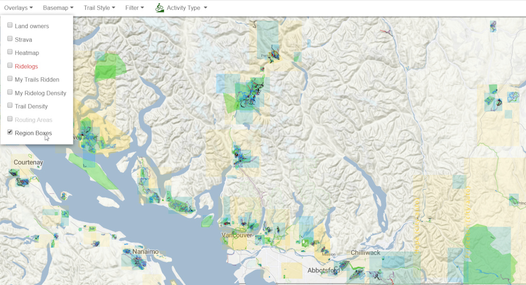
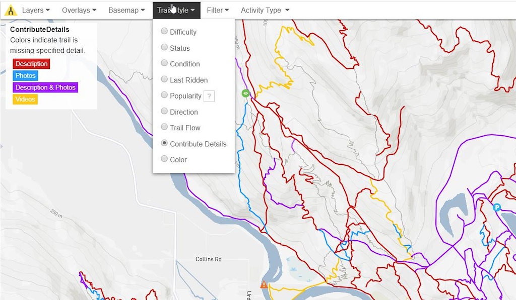
• Map option to show which trails need more contributions. Help add detail to the map!
• Charts for trail work reports. Track which areas and which users have logged the most trail work.
PLUS:
• Add multi-activity support to print map tool. • Better duplicate ridelog detection. • Switch admin email notifications to use user subscribe system. • Re-submit rejected content. Change reject vote. • Show proper trail association for region & trails based on users current activity type. • Trail restricted access field. • Trail reference number field, shown in trail title. • Increase Strava ride import efficiency • Improve elevation data and graphs, smooth & clean data. Running internal elevation service.
App
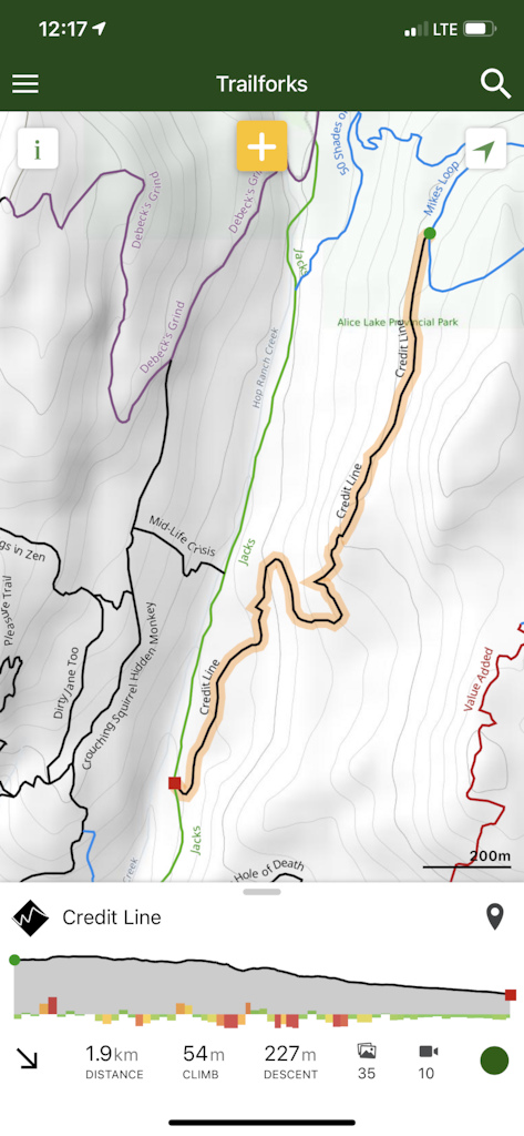
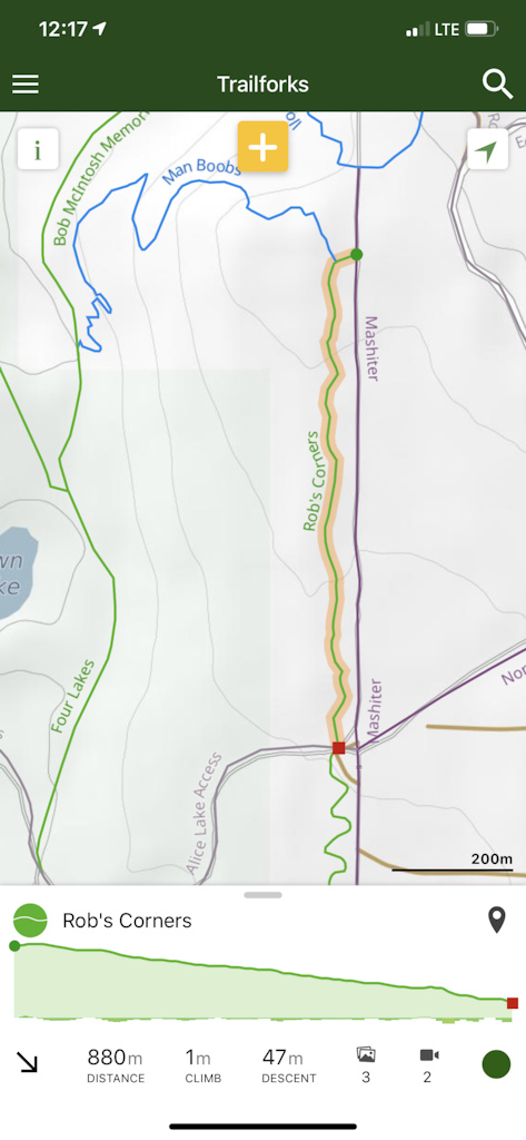
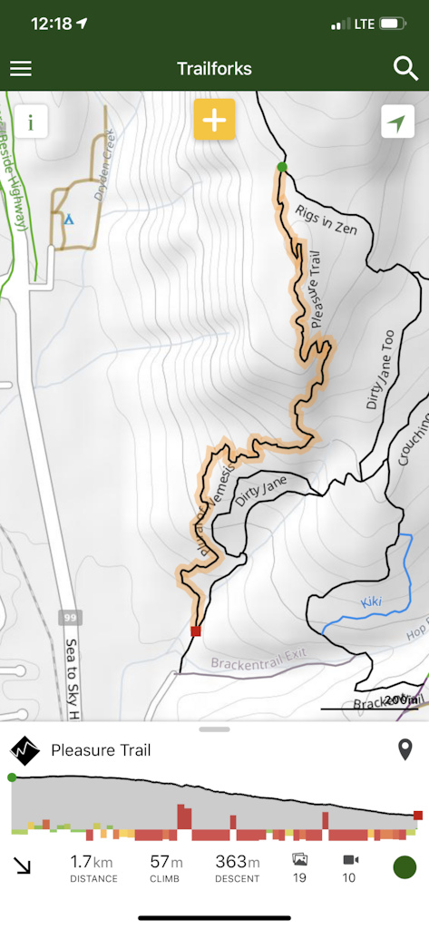
• Show grade on elevation graph. Here we represent the grade data with different colors and different height bars. The color and height of the grade bars are directly proportional to the absolute grade. The grade bars can extend above or below to represent if this is an uphill or downhill section of trail.
Using the trail Credit Line as an example, it looks like there is a punchy climb at the beginning of the trail, followed by a few ups and downs, finishing with a low grade pedal section.
This trail is slightly downhill the whole way with no surprises.
Pleasure trail seems to start off ok, but soon it's downhill steep after steep. It also looks like there will be a punchy uphill or hike-a-bike uphill section, depending on how good you are.
• New My Ridelogs page to browse your past rides and rides from people you follow. • New ridelog detail page.
• Edit ridelog details in-app.
• Trails wishlist moved to main menu along with wishlisted routes & regions as "My Wishlist".
• Auto-select nearby trail on add report and add photo forms if trail selection is empty and photo exif has GPS data.
• New share modal with QR Code sharing
• App notifications for trail reports you subscribe too.
PLUS:
• Upgrade to newer Android SDK with on-demand app permissions. • Different trail difficulty, popularity & trail association per activity type. • View past events. • New POI types.
Infrastructure
• We finally updated some old legacy code so we could update to PHP 7, which offers much performance improvements.
• We are in the process of upgrading many of our servers and adding more capacity.
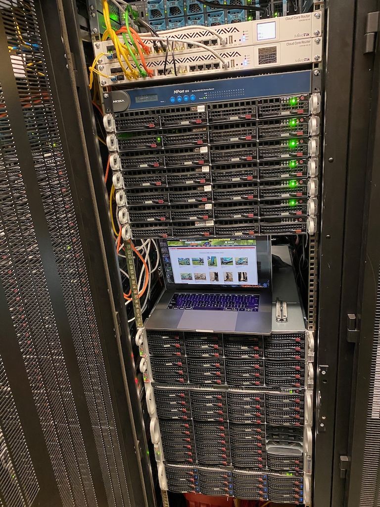
Lots of server and tech upgrades. ( New servers with Intel Optane 4800x NVMe drives, 10/40Gbps networking )
Improved latency to less than 20ms page generation times
• Long-time staff member Brent Hillier stepped away this September to pursue his outdoor education career. We want to thank Brent for his years of devotion to the Trailforks project. Helping it grow and reach more people while hearing the concerns of trail associations.
• We've added a new staff member, Mark Holloway who was previously an ambassador and active contributor. He is helping us communicate with trail associations, manage content and respond to email support.
TF has not only saved my butt a few times, but I've used it to help people who were hopelessly lost. It really should be the 2nd most important thing to get for your bike after a helmet.
The only reason I discovered PB was coz I had to create an account to download Trailforks. Then I ignored the site for years but they kept sending me those monthly emails, not frequent enough to be annoying. One day I got interested in a story and clicked a link. Now here I am... most days. Beware people! :-)
Actually the reason I'm here is coz I'm a wannabe bike nerd and the writing is generally pretty good, which isn't very common. So kudos to PB and its contributors.
@radek: Great work, once the hiking trail database is robust tools to easily create loops and print out said loops is going to be a game changer. Looking forward to it.
Yes and it can be just a simple map of current location and 100 m radius to identify the trail options at any junction where the user is located. I suppose some tracking on off would make sense to but I don’t use it for tracking - I use Strava.
Brent was an awesome resource and easy to work with, I look forward to working with Mark in the future! Thank you for this platform, it has transformed how we log, understand, and present trail information around our neck of the woods.
One feature request: when I build a route, I wish there was a way for the system to recognize an obvious connections along roads. Currently it sends you all over the place!
@endlessblockades: it’s more about traveling light than the stupid circles. I hate riding with a phone. If I had Trailforks on my watch I’d leave the phone at home on the charger.
Absolutely tremendous contribution to mountain biking. Trailforks has opened up trails to so many folks who either didn't know, or were scared to get lost. It is tremendously helpful to backcountry rescue teams.
But I would REALLY like to see an Apple Watch version - while it is less important for my local trails, when I’m visiting somewhere, I hate stopping to pull out my phone at trail junctions. I just can’t justify a standalone garmin to strap to my bar, so would be awesome to just glance at my wrist. (And what is up with people downvoting Apple Watch requests?? )
I love Trailforks!!!
I'm still hoping for a Trailforks Travel feature. I'm imagining a map where property owners post their AirBnB listing. It'd be sweet if riders could plan a road trip and be able to link together places that are owned by riders. I have a rental apartment above my garage. Whenever bikers stay they are stoked with my outdoor bike repair stand, wash station, bike racks, and loaner tools. I've even taken some of the more skilled riders out to show them my favorite local trails.
I love TF. It's a great app. I have a suggestion/concern about the landowner layers, specifically in BC. I work with these layers a lot. The BC Government is transforming it's land ownership layer from the previous CADATSRE dataset into the new ParcelMapBC layer. I believe there are webmapping services for these. My concern lies in how users of TF will choose to interpret these layers. As the CADASTRE is being ported over to over to PMBC, it has been recognized that there is erroneous data. Both in terms of some of the shapes and the attributes ownership information. One should be using both sets of data to attempt to determine ownership. Even then, the data isn't always current and can lead to a TF user crossing into a piece of land that they may not have permission to do so. This can be a liability. If a TF user is in need of determining surface ownership in BC, the best recourse is to approach the Land Title Survey Authority (LTSA) and do some research on the ownership. Mind you, this is a paid service.
As far as I know there is no automatic download of BC government layers built into Trailforks. As you've stated I don't think they have the time/resources to discern the proper private land layers that need to be imported into Trailforks. This is therefore left up to the cycling associations/users to populate Trailforks for this data.
@djbuilder: Quite frankly, I would remove private lands layers from any region on the app. It's a very complicated set of data to work with and more often then not, people get it wrong.
@rossi45: Speaking specifically to Squamish (as I've added a bunch of the private land data here). I felt it's incredibly important to have in Trailforks as many people don't understand that, for example, most of the slab trails are in private land and continued access is an ongoing issue. Trailforks is also much easier to show these parcels than ImapBC. What is your fear in having them? Private land is missed and trespassing occurs?
@djbuilder: My question is, where are you getting your private lands layer? I've outlined the authoritative source(s) of surface ownership data in BC in my original post and the deficiencies of each.... if you were to speak to the Land Title and Survey Authority, they will also state that the only tried and true way of knowing ownership is through title research, not a layer on a map.
@rossi45: Through the Cadastre and PMBC layer. While it may have erroneous data how is that worse than not having private land on a map and everyone assuming it's Crown Land?
@djbuilder: You hit my point exactly. People start assuming things about data when they are provided a piece without context or understanding. As I mentioned, this can be perceived as a liability. You put data on a map, peoples start assuming that it is correct. The whole "well, I thought I was on crown land because the layer on Trailforks says I was" wouldn't stand up in court.
Further to that, your quote "Trailforks is also much easier to show these parcels than iMapBC." is what we fear when people use the layer in a map. The idea of something easy doesn't necessarily mean it is correct.
Please see the quote from the LTSA website for ParcelMap (the eventual authoritative source when CADASTRE is retired):
"ParcelMap BC is a regularly-updated research tool, intended to facilitate searching parcels of land in the province using a representative online map as a precursor to the standard practice of confirmation with authoritative sources and conducting due diligence through a professional consultation."
As I mentioned, the best recourse is to take the data off the map which puts the onus back to the user to make sure they do their own due diligence when determining surface ownership.
@rossi45: So your perspective is either the trail association would pay for the Parcelmap BC service to correctly identify private land parcels to populate Trailforks or you leave the private land data off Trailforks and then at least Trailforks doesn't have the liability?
@djbuilder: ParcelMap is the spatial layer provided by GeoBC (Part of the FLNRO Ministry that manages spatial data and products for the BC Gov). You don't have to pay to use it. It's an open license web mapping layer with limited attributes. It does not provide in depth information on surface ownership such as owner name, address info or transactional history, however it provides PIN/PID numbers to identify the parcel. That is where where the LTSA comes into play. You can take the PIN/PID information and pay to get access to the owners information through their service. Often times, you will need to do some research through the system which is why the LTSA website indicates to get a professional land surveyor to assist with the research.
Quite frankly, land ownership information is quite possibly the most difficult data to collect and interpret. Issues with positional accuracy and attribution are one thing, but getting the data is yet another thing. GeoBC and LTSA work with all levels of government to attempt to retrieve the data. Historically, the province didn't collect the data in all areas. ParcelMap BC is the first attempt to do so, and that only started a couple years ago. The data is only as good as the organization that has collected it. So, for example, let's say Squamish just started to collect the data in 2010, but they only had enough funding to collect newly submitted plans, then they may not have collected older existing plans. Also, methodology on how each organization collected their data can vary widely. Maybe they lost their funding and haven't updated the data in a couple years, so when the ParcelMap BC folks came and asked for the data, there may have been a lot of missing or erroneous data. They only tried and true way to be confident is LTSA research.
I am only touching on just some of the many issues facing the spatial representation that ParcelMap BC provides.
So, in practice, I generally wouldn't put the data on a map for someone who will use it and assume it is correct. When they ask "how do I know who owns the land", I send them to the LTSA and wash my hands of it all. That is the best legal approach. Again, I don't want to assume the responsibility (or the cost) of doing the work where a service is set up to provide it. I use the data, but I am not the owner of the data.
If it is imperative that the data is on the map, it should contain a usage statement of some kind to indicate that it is the users responsibility to make sure they understand who owns the land before entering it.
Thanks for providing us with such a great tool. It really feels like a growing community now. Mark & Trevor do an amazing job with the support side, especially with all the silly questions we keep asking in the Trailforks Admin/Ambassador forums.
Oh and good luck to Brent with his next adventures!
Love the app, use it tons it’s been a game changer... still miss the days of having “secret trails” and sketchy directions like “look for the old boot in the ditch after the 3rd switchback”...
Wondering if the 30dayridechallenge helped to promote more trail submissions this year? Also, love the land owner overlay for finding public lands to camp on near trails, many times it's possible to ride right from the van and onto the trails! Much thanks for all the hard work!
I love Trailforks and use it a ton for local trail riding! Do you have any plans to allow people to upload their own temporary trail to their app for something like a bikepacking route? There are a lot of other apps that do this I know but non seem to have the TF user interface quality.
You can create private routes on trailforks site and just use it yourself or among friends. Routes can be created dynamically on existing trails or you can just upload a private gps track/route.
I love Trailforks! I think it’s great to include other trail users and activities. Personally I don’t like the idea of follow suggestions or making it more “social media-ish”. That’s a big reason I stopped using strava, the alerts for kudos and follower suggestions got to be too much. But maybe I’m just old ????
It is great that you are constantly improving the platform and expanding it to different type of activities but I would prefer to keep away the motor sports. In my country we have a big problem (especially since the pandemic) with illegal off-roading activities. They are destroying the forest roads and trails so we would like to keep such people away from our 'collection' of local trails posted on Trailforks.
Maybe because their infrastructure is not big enough to require the cloud? Yes, going "up there" saves you from some hassle when dealing with the on-prem stuff, networking, storage, systems, etc, etc, etc. But adds some other difficulties and you need people who know how to overcome them. If this works for them, don't see why to move to cloud. Maybe their infrastructure is free because a friend is renting them a piece of his local bitcoin farm? XD
PS: I'm in charge of aprox 100 database servers across several regions, 42 of them on-prem on different data-centers, the rest a mix of EC2 & different flavours of RDS, with +50TB of data moving around on a daily basis (backups, client data, DR, etc, etc)
@elyari: We have our stuff in Equinx Datacenter SV1. Probably the internets best nexus point. We do it this way because it's what we know, it's WAY cheaper, and it's WAY faster than the cloud.
I'm the original developer of Trailforks, but Todd started a site in Utah around the same time. His site Skidmap joined into Trailforks early on. www.trailforks.com/about/skidmap
We've found we could build more performant servers and for cheaper than the best that cloud offerings like AWS can offer. We do use CDNs though.
@radek: thanks for the details, not really up-to-date on data centers details (that why we have the system team), from a quick reading seems indeed a state of the art location. Good to know that Pinkbike has invested on a good infrastructure to keep good content coming (about to publish another article, hope it makes first page...XD) if there is room for a Postgres DBA, let me know
@hamncheez: why surprising? I don't see any surprise on that, cloud is not always cheaper, in fact, many times is borderline same price, and on not so rare cases, more expensive.
Trailforks should create a Strava-type GPS ride tracker. Then it will be specific to MTBers on dirt and you won't have to upload your Strava Ride Logs. Strava is great, but still doesn't have any distinctions between MTB/road biking or dirt/road trails.
@canadaka: using the Ride Log on Trailforks, it would be really cool for clubs and trail orgs to be able to sort segment times for events they host. It would make group/club rides a lot of fun to be able to compare times on a club leaderboard. Informal racing with your club/group/friends is a blast but Strava has made it virtually impossible to do.
@5-9-A2@canadaka: Ahh, you guys are right. I don't use the trailforks app much and didn't notice that. Lol. However, it would be cool if it was like the Strava interface where they list segments, achievements, and different metrics (vertical feet, miles, time, distance, etc) immediately on your phone for each ride.
@tacklingdummy: Yes, depends on what you mean by segment. 1. You start recording in the trailforks app and stop when you are done. 2. It will figure out your ride length, climb, time, etc 3. It will process what trails you rode and give you a time and stats on how you rode each trail 4. It will determine if you reached any achievements or badges and will award those. 5. If you choose you can have your ride sent to strava where strava will process your ride for their segments.
Oh one other thought. I had a look at the Completionist badges in my profile. I have ridden virtually every trail in my riding area multiple times, yet there is a number of trails in my badge progress that I have ridden that shows that I have not. Not sure what's happening there. One example is a trail that I rode recently from start to finish, yet it's still showing that I didn't ride it. Just thought I'd point that out.
Awesome work @canadaka and team, always impressive how many new features go in each year so the growth is well deserved. Also impressive how much riding you get in while still working hard!
The login on the trailforks website is clean, but it does pose an issue when using a password manager like Lastpass - it (Lastpass) doesn't realize that Trailforks is the same account as Pinkbike, as it is URL-based. Changing the password (in the password manager) on one of the sites means you then have to change it manually on the other.
This would be moot if LastPass gave you the ability to link logins, but I don't think that's an option.
Something I wish it did. When I’m traveling and I arrive at a trailhead, opening the app it would instantly know I was there and offer up the most popular routes/loops with basic profile info. Literally without a tap, or maybe have a button on what comes up now for this instant option. I know, should do the research before arriving. But human nature is human nature. I’m on a trip to OR and decide to drive to Sandy Ridge. Open app and voila, several routes/loops pop right up for me to select and just ride. Keeping it super simple. Or, imagine it’s like Zwift. Courses offered up based on the world you’re in.
when you arrive at Sandy Ridge, click the "Discover" button at the bottom of the map. It shows popular routes and other info for the area the map is centered on.
Is there a Way to remove Trails from Trailfork ? Where I'm riding someone put 3 Trails marked as Downhill on Trailforks but they are cloesed of to Bikes by the Landowner. I fear that with the Trails on the Map a lot of People will ride them even though they are cloesd
@RockCrawler If they are closed to bikes but open to other activities than just submit an edit and change the activity types allowed on that trail. PM me and I can work with you on sorting this out.
Excellent Trailforks! Discovered the contours overlay for satellite images recently, and have already used it a bunch for checking out backcountry ski routes. One thing on my wishlist would be the ability to do a "regional conditions report". For instance- I rode Paskapoo Slopes in Calgary yesterday, on a route taking in probably 15 different trails. Rather than selecting a handful (or all!) for a bulk trail report, why not have a regional option as well, for use where conditions are common throughout a trail network. Also- yesterday the trails were a mix of "snow packed", and "melt freeze cycle"- it would be nice to be able to select a couple of descriptors rather than just one. Finally- there is often a big discrepancy between the elevation gain/loss that GAIA shows on my iPhone, versus what is shown on TF should I upload a route. TF always indicates much more in cumulative elevation- (good for the ego!) but in some cases at least, I can say that TF is definitely overstating it. Keep up the great work!
I really like TF. I dont like the promo of other sports being promoted of MTB focused database of trail knowledge. BELIVE me this in the future will effect mtb access in negative way. Great for TF popularity...but it could google out
The build your own route thing on the website is amazing. That must have been interesting/fun to build. What's up with the app making requests to google and facebook? They don't really need to collect more data on me.
Trail Forks is awesome! It has helped make sure I can find trails and trail system I did not know about. question/request when will breweries and restaurants be added as a POI so we can tag our FAV post ride places?
I love the app, but now we have to pay for these upgrades, we only get one free area? wow I am now bummed, only feature I want is free to see the trails, dont need all this other stuff we now have to pay for.
Please consider adding heart rate monitor support to the app. It’s a fantastic biking resource, but I’d love to use it for fitness tracking as well. Thanks!
i started using trailforks, tracked my ride and uploaded it but cant figure out how to upload images to my uploaded ride (like i used to be able while using strava)?
We actually don't have ridelog photos as a feature currently. It's something we'll eventually ad. If you upload photos to trails that are taken at the same time as your ridelog, they will be listed on your ridelog detail page on the website, but aren't specifically "linked" to the ridelog.
This already may be a feature? Anyway we could have a filter for trail type: "Jump (A-line style)", "Jump(B-line style)", "Single Track (Handbuilt)" "Machine Flow" etc
@gav-s: What does Trailforks admin do? Managed to put it up on there, but do not own a smart phone or take one riding with me! Will every one be happy when surgical implanted phones are a thing?
@aljoburr: check @trailforks help section (www.trailforks.com/help/view/70) An extract: "There are several different ways trails & other content is approved & moderated. Our preferred method is assigning users from a local trail association with moderator permissions over the content in their region. So if a new trail is added in your region, this user would be notified and make the decision to approve, deny or modify it. This takes time to build up this database of local admins, we vet each application for region admin and give preference to directors from trail associations. But also give control to other groups or local users if its ok with the local association or no one steps up."
And also here: What is a Regional Admin? www.trailforks.com/help/view/64 "The expectations of a regional admin are they will oversee the content confirmation, quality and curation for their region. We much rather have locals doing this rather than Trailforks staff, as a local knows their area and politics better. Regional admins are usually members of the local trail association board of directors. But the system will work regardless of how active a regional admin chooses to be, it might just mean updates and new content take longer to be approved and could result in some bad data falling through the cracks. But that’s the power of a crowd-sourced wiki like database, any missing, incorrect or sensitive data can be revised by anyone."
Actually the reason I'm here is coz I'm a wannabe bike nerd and the writing is generally pretty good, which isn't very common. So kudos to PB and its contributors.
One feature request: when I build a route, I wish there was a way for the system to recognize an obvious connections along roads. Currently it sends you all over the place!
Example: www.trailforks.com/trails/supersonic/tour
But I would REALLY like to see an Apple Watch version - while it is less important for my local trails, when I’m visiting somewhere, I hate stopping to pull out my phone at trail junctions. I just can’t justify a standalone garmin to strap to my bar, so would be awesome to just glance at my wrist.
(And what is up with people downvoting Apple Watch requests?? )
Edit: Crap - looks like I only had a trial period on LandGlide! Bummer. There is one called Hunting Points on IOS that is free though.
Further to that, your quote "Trailforks is also much easier to show these parcels than iMapBC." is what we fear when people use the layer in a map. The idea of something easy doesn't necessarily mean it is correct.
Please see the quote from the LTSA website for ParcelMap (the eventual authoritative source when CADASTRE is retired):
"ParcelMap BC is a regularly-updated research tool, intended to facilitate searching parcels of land in the province using a representative online map as a precursor to the standard practice of confirmation with authoritative sources and conducting due diligence through a professional consultation."
help.ltsa.ca/parcelmap-bc
As I mentioned, the best recourse is to take the data off the map which puts the onus back to the user to make sure they do their own due diligence when determining surface ownership.
Quite frankly, land ownership information is quite possibly the most difficult data to collect and interpret. Issues with positional accuracy and attribution are one thing, but getting the data is yet another thing. GeoBC and LTSA work with all levels of government to attempt to retrieve the data. Historically, the province didn't collect the data in all areas. ParcelMap BC is the first attempt to do so, and that only started a couple years ago. The data is only as good as the organization that has collected it. So, for example, let's say Squamish just started to collect the data in 2010, but they only had enough funding to collect newly submitted plans, then they may not have collected older existing plans. Also, methodology on how each organization collected their data can vary widely. Maybe they lost their funding and haven't updated the data in a couple years, so when the ParcelMap BC folks came and asked for the data, there may have been a lot of missing or erroneous data. They only tried and true way to be confident is LTSA research.
I am only touching on just some of the many issues facing the spatial representation that ParcelMap BC provides.
So, in practice, I generally wouldn't put the data on a map for someone who will use it and assume it is correct. When they ask "how do I know who owns the land", I send them to the LTSA and wash my hands of it all. That is the best legal approach. Again, I don't want to assume the responsibility (or the cost) of doing the work where a service is set up to provide it. I use the data, but I am not the owner of the data.
If it is imperative that the data is on the map, it should contain a usage statement of some kind to indicate that it is the users responsibility to make sure they understand who owns the land before entering it.
Mark & Trevor do an amazing job with the support side, especially with all the silly questions we keep asking in the Trailforks Admin/Ambassador forums.
Oh and good luck to Brent with his next adventures!
Also, why are you using local servers!? What a nightmare (as is php5)
The real friday fails
PS: I'm in charge of aprox 100 database servers across several regions, 42 of them on-prem on different data-centers, the rest a mix of EC2 & different flavours of RDS, with +50TB of data moving around on a daily basis (backups, client data, DR, etc, etc)
We do it this way because it's what we know, it's WAY cheaper, and it's WAY faster than the cloud.
We've found we could build more performant servers and for cheaper than the best that cloud offerings like AWS can offer. We do use CDNs though.
@radek Thats really cheaper than something you could set up on AWS? Thats surprising.
1. You start recording in the trailforks app and stop when you are done.
2. It will figure out your ride length, climb, time, etc
3. It will process what trails you rode and give you a time and stats on how you rode each trail
4. It will determine if you reached any achievements or badges and will award those.
5. If you choose you can have your ride sent to strava where strava will process your ride for their segments.
Love Trailforks and use it all the time, it's the best thing to happen to mountain biking since the dropper post. Keep up the good work!
This would be moot if LastPass gave you the ability to link logins, but I don't think that's an option.
One thing on my wishlist would be the ability to do a "regional conditions report".
For instance- I rode Paskapoo Slopes in Calgary yesterday, on a route taking in probably 15 different trails. Rather than selecting a handful (or all!) for a bulk trail report, why not have a regional option as well, for use where conditions are common throughout a trail network.
Also- yesterday the trails were a mix of "snow packed", and "melt freeze cycle"- it would be nice to be able to select a couple of descriptors rather than just one.
Finally- there is often a big discrepancy between the elevation gain/loss that GAIA shows on my iPhone, versus what is shown on TF should I upload a route. TF always indicates much more in cumulative elevation- (good for the ego!) but in some cases at least, I can say that TF is definitely overstating it.
Keep up the great work!
What's up with the app making requests to google and facebook? They don't really need to collect more data on me.
question/request when will breweries and restaurants be added as a POI so we can tag our FAV post ride places?
Well they are their, but not the location?
I'm the Trailforks admin for your area. If you need any help on getting your trails on the system, please feel free to give me a shout.
Managed to put it up on there, but do not own a smart phone or take one riding with me!
Will every one be happy when surgical implanted phones are a thing?
And also here: What is a Regional Admin? www.trailforks.com/help/view/64
"The expectations of a regional admin are they will oversee the content confirmation, quality and curation for their region. We much rather have locals doing this rather than Trailforks staff, as a local knows their area and politics better. Regional admins are usually members of the local trail association board of directors. But the system will work regardless of how active a regional admin chooses to be, it might just mean updates and new content take longer to be approved and could result in some bad data falling through the cracks. But that’s the power of a crowd-sourced wiki like database, any missing, incorrect or sensitive data can be revised by anyone."